


Mt. Olympus Mountaineer’s Map
Price range: $35 through $330
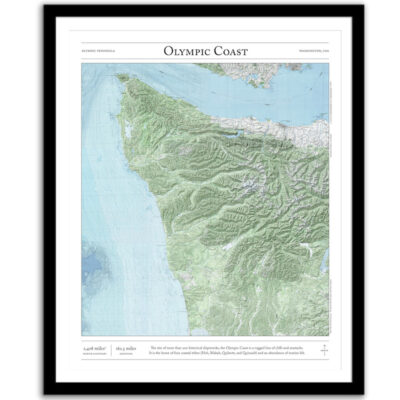
Bring the wilderness home with this print of the standard mountaineering route to the summit of Mount Olympus in Washington’s Olympic National Park. This trail map combines hillshading, detailed topography, and route info to tell the story of your time on the mountain. Made by an independent artist.
For illustrative use only. Not for navigation. Routes above treeline change frequently.
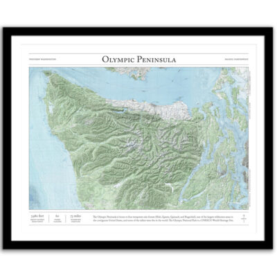
About Mount Olympus
Hike through old-growth temperate rainforest to Glacier Meadows and the foot of the Blue Glacier. Cross the third largest glacial system in the contiguous United States, then climb one pitch to the top of the summit pyramid and the highest point on the Olympic Peninsula.
- Summit elevation: 7,980 feet
- Distance (round-trip): 44 miles
- Elevation gain: 7,400 feet
I hope my wall art brings you closer to one of your favorite places. It’s a perfect gift for hiking partners, friends, and family members who love the outdoors and the Olympic Mountains.
Text and/or cropping might vary slightly at different map sizes. Please view the photos above to see the exact content on the 11×14, 16×20, and 22×28 maps.
Josh did an amazing job customizing a Mt Rainier map for me to give to a friend. The print and frame are professionally packaged and high quality My friend loved the print. Josh is responsive, patient and so easy to work with. I will definitely order from Paper Cairns again!
Beautiful quality every time. I’ll be buying more for myself and as gifts.
Map is beautiful – I love that our wonderland trail route is marked as with a lot of landmarks we visited along the way. My son will love it when he gets it for his birthday! Thank you!