


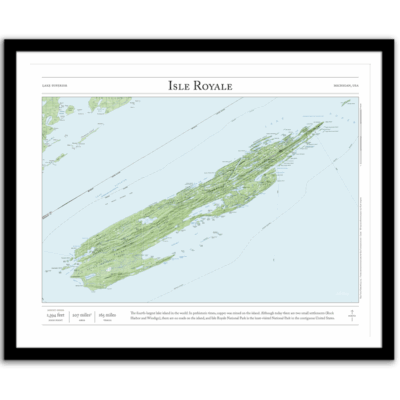
Isle Royale Backpacker’s Map
Price range: $55 through $340
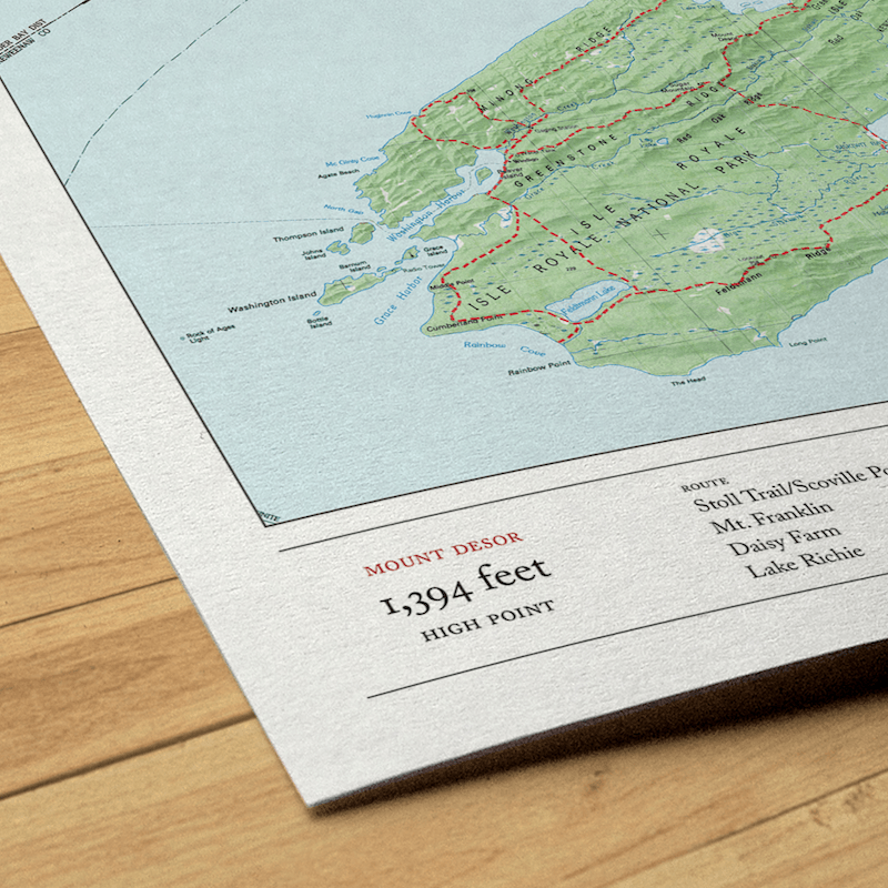
Bring the wilderness home with this map of all the main hiking trails on Michigan’s Isle Royale National Park in Lake Superior. This map combines hillshading, detailed topography, and route info to tell the story of your time on the island, whether you were backpacking, camping, hiking, fishing, or otherwise exploring. Made by an independent artist.
For illustrative use only. Not for navigation.
Routes that appear on the map
- Stoll Trail/Scoville Point
- Mt. Franklin
- Daisy Farm
- Lake Richie
- Huginnin Cove Loop
- Mount Desor
- Lake Desor
- Feldtmann Lake Loop
- Minong Ridge
- Greenstone Ridge
- Minong + Greenstone Loop
- Indian Portage
Text and/or cropping might vary slightly at different map sizes. Please view the photos above to see the exact content on the 11×14, 16×20, and 22×28 maps.
Josh did an amazing job customizing a Mt Rainier map for me to give to a friend. The print and frame are professionally packaged and high quality My friend loved the print. Josh is responsive, patient and so easy to work with. I will definitely order from Paper Cairns again!
Beautiful quality every time. I’ll be buying more for myself and as gifts.
Map is beautiful – I love that our wonderland trail route is marked as with a lot of landmarks we visited along the way. My son will love it when he gets it for his birthday! Thank you!