


Isle Royale (no trails)
Price range: $55 through $340
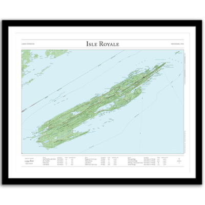
Bring the wilderness home with this map of Michigan’s Isle Royale National Park in Lake Superior. This map combines hillshading, detailed topography, and route info to tell the story of your time on the island. Made by an independent artist.
For illustrative use only. Not for navigation.
Text that appears on the map
- The fourth-largest lake island in the world. In prehistoric times, copper was mined on the island. Although today there are two small settlements (Rock Harbor and Windigo), there are no roads on the island, and Isle Royale National Park is the least-visited National Park in the contiguous United States.
- High point: Mount Desor (1,394 feet)
- 207 square miles
- 165 miles of trails
Text and/or cropping might vary slightly at different map sizes. Please view the photos above to see the exact content on the 11×14, 16×20, and 22×28 maps.
Josh did an amazing job customizing a Mt Rainier map for me to give to a friend. The print and frame are professionally packaged and high quality My friend loved the print. Josh is responsive, patient and so easy to work with. I will definitely order from Paper Cairns again!
Beautiful quality every time. I’ll be buying more for myself and as gifts.
Map is beautiful – I love that our wonderland trail route is marked as with a lot of landmarks we visited along the way. My son will love it when he gets it for his birthday! Thank you!