
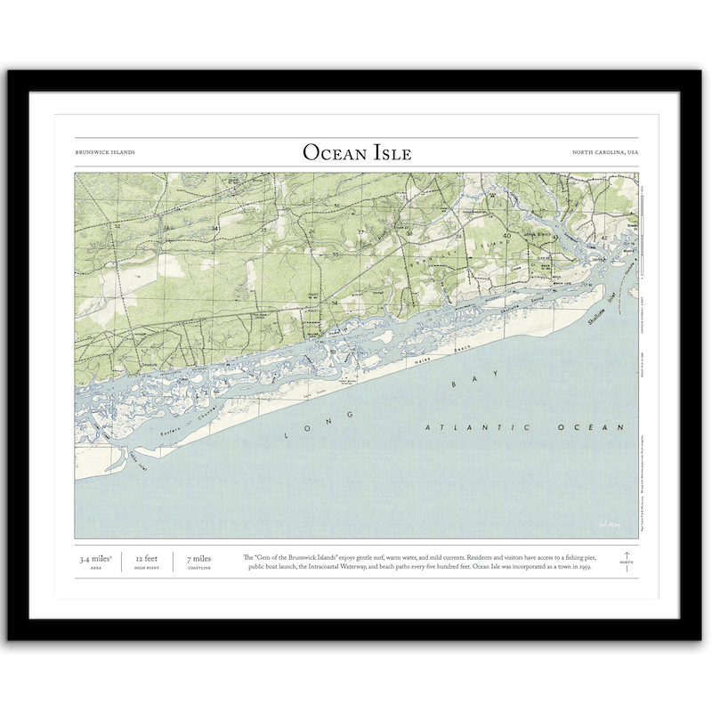


Ocean Isle, NC
Price range: $35 through $330
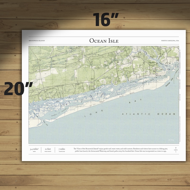
Bring home the story of the island with this print of Ocean Isle in North Carolina. Based on original data from 1950—before the island was developed—this map combines hillshading and detailed topography to show the history of this beloved barrier island. Made by an independent artist.
About Ocean Isle
The “Gem of the Brunswick Islands” enjoys gentle surf, warm water, and mild currents. After crossing the bridge from the mainland, the island’s residents and visitors have access to a fishing pier, public boat launch, the Intracoastal Waterway, and beach paths every five hundred feet. Ocean Isle was incorporated as a town in 1959 (this map is from 1950, before development). In 2008, it won the Best Restored Beach Award.
- High point: 12 feet
- 4.3 square miles
- 7 miles of coastline
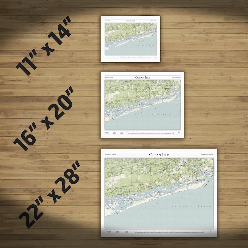
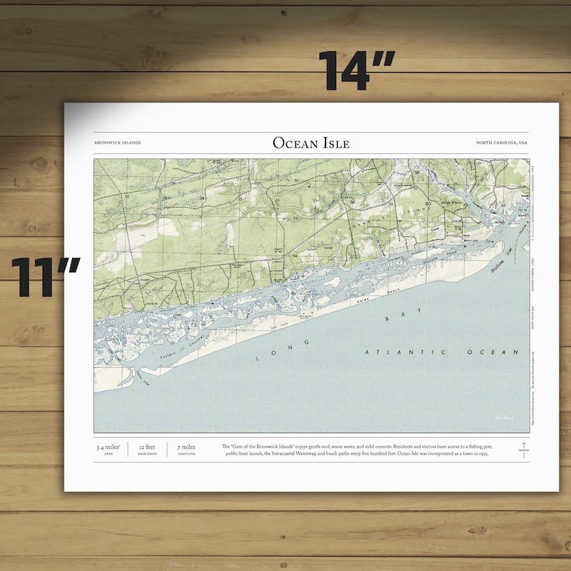
Text and/or cropping might vary slightly at different map sizes. Please view the photos above to see the exact content on the 11×14, 16×20, and 22×28 maps.
| 5 star | 100% | |
| 4 star | 0% | |
| 3 star | 0% | |
| 2 star | 0% | |
| 1 star | 0% |
Customer Images


Small maps – 11″ x 14″
- Poster paper (unframed)
- Fine art giclee print (unframed)
- Framed fine art giclee print
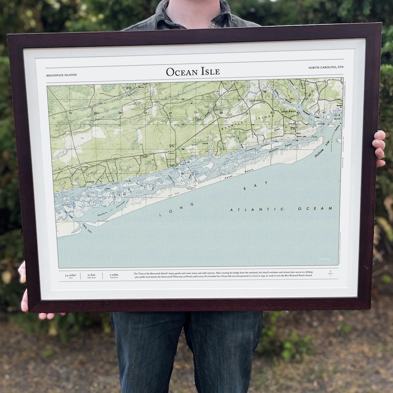
Medium maps – 16″ x 20″
- Poster paper (unframed)
- Fine art giclee print (unframed)
- Framed fine art giclee print – Shown in the lifestyle photo. Model is 5' 9" tall.
Large Maps – 22″ x 28″
- Poster paper (unframed)
- Fine art giclee print (unframed)
- Framed fine art giclee print
Paper
- Poster Paper — classic poster paper with a satin finish, bright white point, and vivid color.
- Giclée — acid-free archival-grade ink, acid-free 100% cotton, single-side coated paper. Has a matte surface.
Frames (Giclee only)
- Black Frame — ¾” wide, wood with veneer
- Walnut Fame — 1 1/4” wide, wood
- Maple Frame — 1 1/4” wide, wood
- Matting — 1” wide, conservation-grade (white)
Production Time
- Average printing/production time for paper only (poster or giclee) is 3–5 business days.
- Average printing/production time for paper and a frame is 5–8 business days.
Shipping Time
- Unframed prints ship via USPS (3–6 business days).
- Framed prints ship via UPS (3–6 business days).
- International shipping is not available at this time.
Returns and Refunds
- Do you accepts returns or give refunds?
Because I print each map specifically for each order, I’m not able to accept returns or offer refunds. - If your item was damaged during shipping, please let me know and I’ll work with my printing partner to send you replacement copy.
Process
I use precise digital elevation models (DEMs) to create shaded relief for every valley, ridge, peak, and river, which I add to vintage 1:24,000 topo maps from the United States Geological Survey. These historic maps were originally printed on a lithographic press and field-checked on foot, and they give each print a natural, authentic feel.
Commission a Personal Map
If I don't have a map for a trail or place you love, you can commission a personal map. You can also vote for the next map.
Legal Disclaimer
My maps are for illustrative purposes only. Although almost all the natural features are accurate, historic USGS maps are of varying age, reliability, and resolution, glaciers and routes above treeline change frequently. These prints should not be used for navigation, land ownership claims, or up-to-date information about public access.


An amazing map with exactly the right data and art work. Nothing else like this exists. Completely unique.
The map is beautiful and it was delivered so quickly. We are so excited to use it as wedding guest book. Would absolutely recommend
Gorgeous, boyfriend loved it. Great quality and fast shipping.
absolutely gorgeous maps! I cannot wait to get a custom frame to show them off!